
Maps show Hurricane Kiko’s path and forecast in Pacific as it moves west toward Hawaii
Hurricane Kiko, a powerful Category 4 storm, is swirling in the Pacific Ocean and heading west in a direction toward Hawaii.
Forecasters warned that swells from the storm could reach the Hawaiian Islands by the end of the weekend and cause life-threatening surf and rip currents. On Saturday, forecasters at the Miami-based National Hurricane Center said Kiko weakened some as it moved west-northwestward through the Central Pacific.
No coastal watches or warnings were in effect as of Saturday morning. Maui and the Big Island are expected to see swells generated by the storm by Sunday and last through midweek. The swells may produce life-threatening surf and rip currents, the National Hurricane Center said.
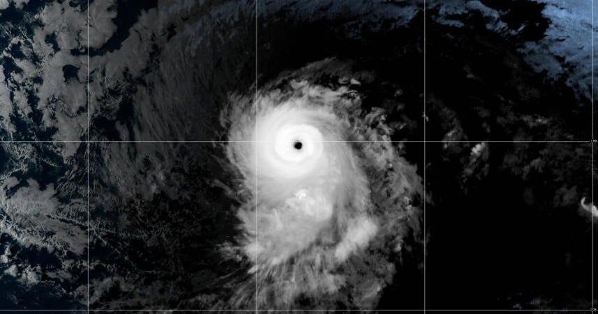
NOAA/NESDIS/STAR 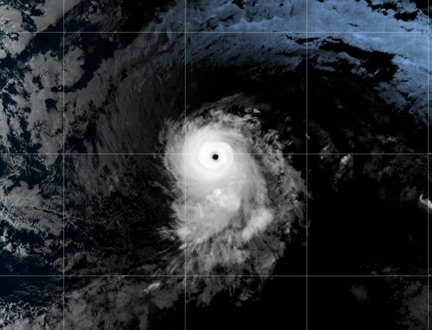
Maps show Hurricane Kiko’s forecast path
While Kiko is traveling slowly, Hawaii is becoming more in its line of sight for potential direct impacts such as winds and rainfall starting Monday. The main threats are forecast for Tuesday, according to Nikki Nolan, a meteorologist for CBS News and Stations.
Acting Hawaii Gov. Sylvia Luke on Friday declared a state of emergency due to the possible inclement weather posed by Kiko. “We urge residents and visitors to monitor updates, follow official guidance and prepare accordingly,” Luke said.
The National Weather Service in Honolulu is monitoring Kiko’s possible impacts and anticipating heavy rainfall leading to potential flooding — along with high surf — early next week.
This map details the forecast path of the storm, showing it moving closer to the Hawaiian Islands this weekend:
CBS News 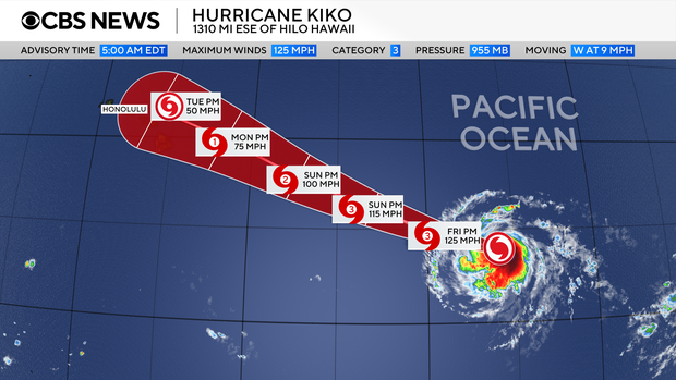
Another map, from the National Hurricane Center, shows that tropical-storm-force winds could start affecting Hawaii on Monday.
NOAA 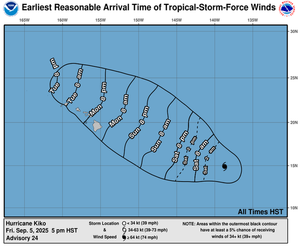
As the CBS affiliate in Honolulu notes, however, it is too soon to tell where exactly the storm will go in relation to Hawaii, as the forecast track can change.